Physical Context
Africa—a complex continent with a complex history and story up through the modern day. Put aside your preconceptions and stereotypes you might have about the land and people of Africa. You'll soon gain an overview of the physical geology, human geography, and the interactions between these topics.
We also need to start looking at Africa differently than we have done previously. We are typically bombarded by the standard physical geography map, such as this one, when we study other continents and countries:
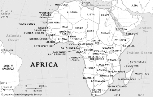
Source: National Geographic
But in order to understand the environments of Africa, we need to remove these country boundaries. Political boundaries are one way to divide the continent, but we're interested in examining features and phenomena that don't know where the boundaries and borders of countries are, such as this map shows:
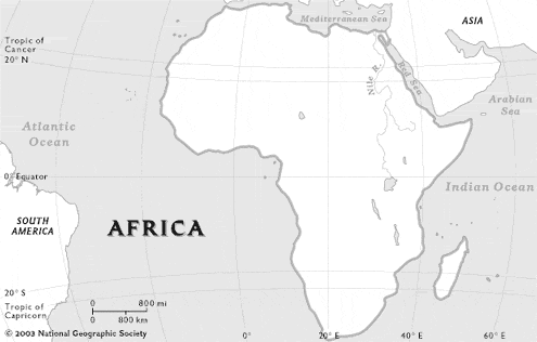
Source: National Geographic
So let's start visualizing a clean map and we'll add the layers of vegetation, climate, population, biodiversity, etc. We'll still use some of the political country boundaries as an easy reference on the map, but remember that rivers and wildlife (and in some cases people) ignore these boundaries of separation!
Africa can be called a "Land of Contrasts." As one moves across the continent, extreme differences exist in wealth and poverty, landscapes of rivers, forests and deserts, mountains and plains, mineral-rich resources under destitute landscapes, and European values superimposed on traditional cultural practices.
Africa is the second largest continental landmass on the planet. It covers approximately 11.8 million square miles (30.5 square kilometers) - that's 22% of Earth's surface. Check out how other countries and nations can fit in the continent! In fact, the continental United States is approximately the same size as the Sahara Desert! (See image below.)
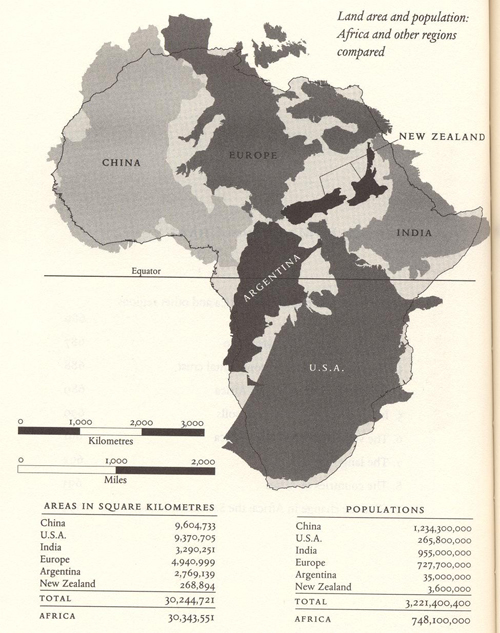
Source: Reader, J. (1997). Africa: A Biography of the Continent. Vintage Books, New York. p. 686.