| |
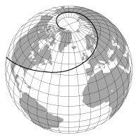
| Figure 10-1. A rhumb line on the earth |
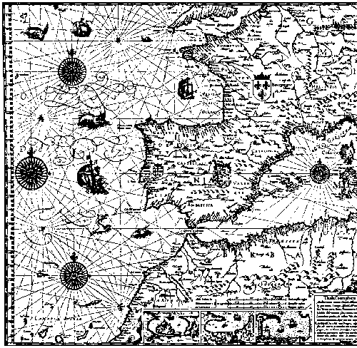 | |
| Figure 10-2. A portion of W. Barent's chart of the Mediterranean showing radiating rhumbs. From Nordenskiöld, A. E. 1889. Facsmimile-Atlas... New York: reprinted Dover Publications, 1973, p. 39 |
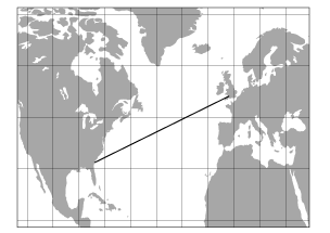 | |
| Figure 10-3. An Equirectangular projection of the North Atlantic with an incorrect "rhumb" |
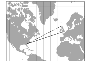 | |
| Figure 10-4. A Mercator projection of the regionin Figure 10-3 with the correct rhumb. The dashed line shows where the "rhumb" on Figure 10-3 would have led |