Mapping the Nile
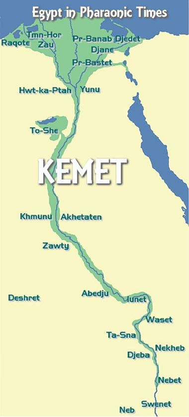
The map below shows the Nile River in Egypt (you can see three or four distributaries within the delta) and indicates several Ancient Egyptian cities from north to south, many of which still exist today under other names: Ancient Tmn-Hor is today's Damanhur, Pr-Banab Djedet is Tell al-Rub, Djane is Tanis city and Pr-Bastet is Tell Basta, home of the famous ancient cat temple.
There was no Cairo until 1000 years ago, but an older capital, Hwt-ka-Ptah (Memphis) was on the west bank and Yunu on the east. Yunu is the temple area called On in the Bible and later became Heliopolis.
To-She is the manmade oasis of Fayoum. Waset is the ancient name for Luxor and not the Greek name Thebes. Further south Nebet is today Kom Ombo and Abu is the ancient name for Aswan. Kemet, "the Black Land" is the ancient name of Egypt while Deshret "the Red Land" was the name for the desert.

Egypt in Pharaonic Times. Source: EgyptMyWay
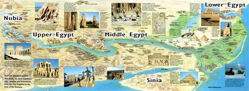
The following map shows yet a third orientation—with the river flowing left to right across the page. We see again the cities of ancient Egypt and the classification of Upper, Middle and Lower—not the North-South geography we think of today, but related to the river itself. Upper Egypt means "upstream" Egypt or (because water flows downhill) "uphill" Egypt.

Map of ancient Egyptian cities and the Nile River. Click on the image above to access a Web site that contains a much larger (readable) version! Source: The River Nile in Egypt - http://homepages.tcp.co.uk/~nicholson/egypt/nilemap.html
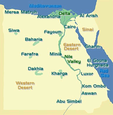
We mentioned Fayyum (here spelled Fayoum), the first man-made oasis in Egypt. Below we see several of the ancient oases, all of which are still in use today. By "in use" we mean either for agriculture (as was the original use of the Fayyum, for example) or for residential areas that include tourism. We'll learn more about oases later this term, so it is helpful to be introduced to them now.

Ancient oases still in use for agriculture. Source: EgyptMyWay

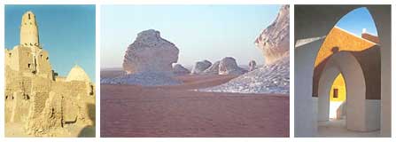
Images from oases. Source: EgyptMyWay