The Meeting of the Niles
At Khartoum the White and Blue Nile branches meet. The Blue Nile carries roughly twice the water of the White Nile, but its flow is concentrated in the months between July and November. Some 500 km north of Khartoum the Nile (locally called the Nubian Nile) is joined by its final major tributary, the Atbara, which drains the northern Ethiopian highlands. The Atbara is a strong but seasonal input to the Nubian Nile: it is dry during the months from December to May but floods mightily between July and October. The monsoonal rains in the Ethiopian highlands thus drive seasonal flooding along the length of the Nile from below Khartoum to its outlet in the Mediterranean Sea.
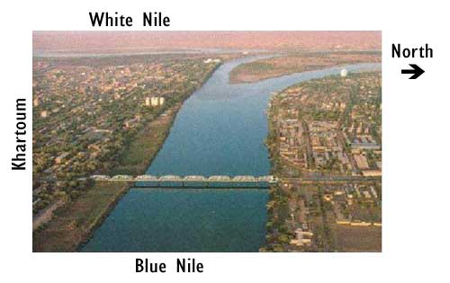
Confluence of the White and Blue Nile rivers in Khartoum, Sudan. Source: From the personal collection of Dr. Tanya Furman.
What do YOU think? The Meeting of the Niles in Khartoum
What do you think are the positives and negatives of the human development at Khartoum, where the White Nile and Blue Nile meet? Explain your ideas for BOTH the pluses and minuses on the Lesson 04 Discussion Forum (you can easily find that discussion forum by looking under the Communicate tab in ANGEL and then looking in the Discussion Forums box.) You may want to look at the photos throughout this lesson for inspiration!
North of Khartoum the river passes through a series of six major cataracts through which it drops from 375 to 90 meters above sea level en route to Aswan (Egypt), a distance of 1850 km. This stretch of the Nile traverses the Sahara desert, where it receives no input from rain or tributaries. The major S-shaped bend in the Nile occurs here as well, as the river has carved deep trenches through hard sandstone bedrock in the stretches between the cataracts. The cataracts themselves are not waterfalls but rather long stretches of fairly steep rocky terrain e.g., the Fourth Cataract extends for 110 km with a change in elevation of about 50 meters—not impressive when compared to slopes in the headwater regions, but much steeper than the intervening areas or the Sudd. The cataracts reflect the gradual erosion of the Nubian sandstone—a fairly soft and horizontal rock unit that underlies the flat, broad portion of the Nile—and the resulting exposure of the underlying granitic rocks, which are much harder and tend to erode in narrow channels.
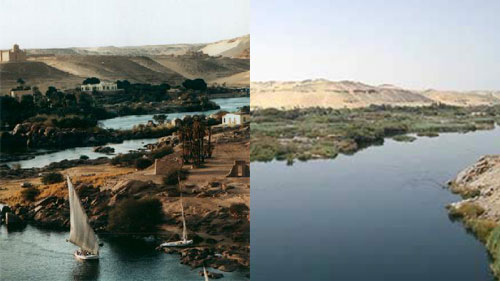
The cataracts in southern Egypt. Source: AfricanWater.org and TourEgypt
From Aswan north to the Mediterranean, the Nile slopes very gently: roughly 1 meter down per 12-15 km traveled. In this area, the Nile broadens to a width of up to 16 km and flows through a channel it has cut in its own silty deposits. These sediments were laid down annually during flooding—triggered, of course, by the local arrival of influx from the Ethiopian highlands—until the completion of the first Aswan dam around 1900.
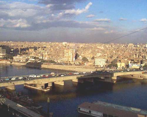
The Nile in Cairo. Source: AfricanWater.org
Just south of Cairo, the Nile divides into two rivers (or distributaries) known as the Rosetta and Damietta branches. These form part of the great Nile delta, which is composed of fine silt from the basalts of the Ethiopian highlands.
The following map shows the topography of the Nile River basin. You can see how the Earth's surface slopes down from the headwater regions (make sure you know where they are!) towards the delta.
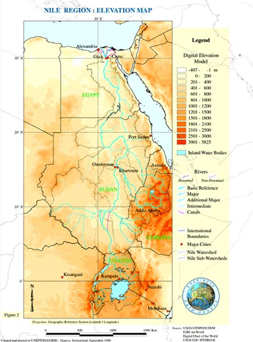
Map showing elevation in the Nile Basin. Source: United Nations Environment Program
The chart below shows the stream gradient - essentially the downhill slope - traveled by the White and Blue Niles from the headwaters to the Mediterranean Sea.
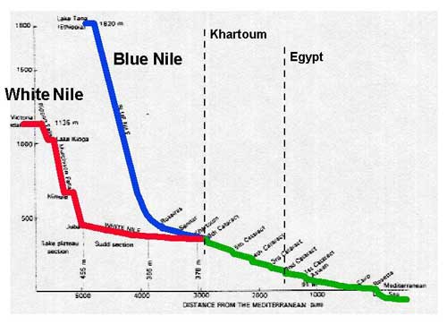
Change in slope along the the length of the Nile River. Source: Barbara Tewksbury, Hamilton College.