History of the Nile
Back to the history of the Nile.
When geologists say "ancient" we really mean it. We are accustomed to working in time periods of hundreds of millions of years. In this course, we will generally stick to the most recent 11,000 years, the time period following the most recent Ice Age. Occasionally, however, we will look even further back into geologic time. Today we mention these ancient days briefly as an introduction to you about this long-term perspective that geology brings to the course, and the inter-relationships you will be learning to make on your own, among geology, climate and water resources.
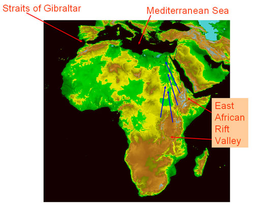
The history of the Nile begins ~6 million years ago (which we abbreviate Ma), a time of tremendous change in terms of global climate and regional geology. About 6 Ma, the Mediterranean Sea became cut off temporarily from the Atlantic Ocean through tectonic (geologic) activity that closed the Straits of Gibraltar. At that time, global temperatures higher than those today caused the 'ponded' Mediterranean to dry out almost entirely, leaving behind several thousand meters of salts (e.g., table salt, gypsum).

A topographic map of Africa. Areas in brown (capped by bits of white) are regions of high elevation, whereas the green colors indicate elevations approaching sea level. Notice the major area of high topography that runs roughly NE-SW across the continent. The headwaters of the Nile are located in the mountains of central Africa (the equatorial lakes region) and in the Ethiopian highlands. Since all rivers flow downhill, the Nile must drain towards the north. Source: National Geophysical Data Center

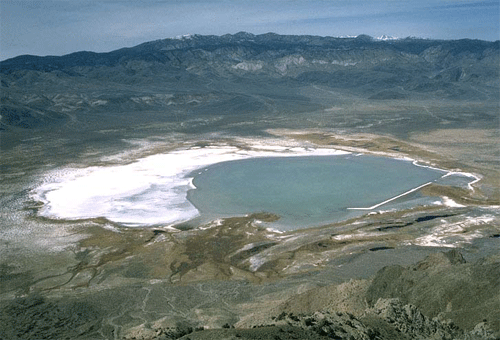
A Playa Lake - Deep Springs Lake, eastern California. Source: Dr. Marli Miller (email: millerm@darkwing.uoregon.edu)
The Nile should have dried up entirely at this time, but it received additional water as a result of tectonic changes in the headwater region associated with formation of the East African Rift Valley. The term headwater simply refers to the area of highest elevation where a river begins. To summarize briefly, gradual lifting and tilting of the earth's crust along a zone that extends over 3000 km from Ethiopia and the Red Sea southwards towards Mozambique caused changes in the Nile basin. Most importantly, the tectonic uplift elevated the Nile headwaters and helped direct waters towards the north, away from the Congo basin and the Indian Ocean. That interaction between geological forces and climate factors made the Nile we know.
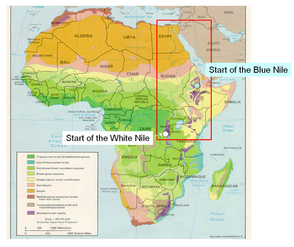
Examine a map of Africa. You should see that the Nile River has two branches (the White and Blue Niles) and they carry rain that falls in the two headwater regions: the Equatorial Rift Lakes (for the White) and the Ethiopian Highlands (for the Blue).

Ecosystem map of the African continent. Source: http://www.lib.utexas.edu/maps/africa/africa_veg_86.jpg
The modern Nile is the longest river in the world. Its southernmost headwaters are located just south of the equator in east-central Africa, and it flows northward towards the Mediterranean Sea, a journey of roughly 35° of latitude. It travels an incredible 4,130 miles (6,645 kilometers) during this journey. There are tremendous geographic and climatic variations within the Nile drainage basin, which includes mountains, swamps, waterfalls and the world's largest desert.